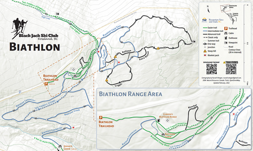
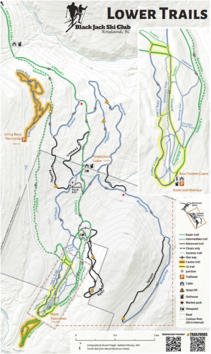
trail maps
shiny new maps built 100% in qgis
This was a volunteer project for Black Jack Ski Club to update trail signs, as well as transition away from proprietary software (Esri and Adobe Illustrator) to a free, open-source workflow. This required independently learning QGIS cartography (having only used QGIS for satellite imagery raster processing previously).
These maps required extensive used of rule-based and data-defined symbology and labelling. As well, custom icons were created using Inkscape. Feature data was drawn from OpenStreepMap, which I help curate and update in our region.
Publication specifications: 20” x 12” reflective vinyl signboards


Check these bad boys out in high resolution over here. Or better yet go see them out on the trails.